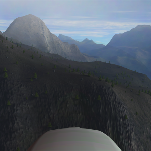
 Captain Jebediah takes the Civvie around the KSC region for additional atmospheric readings, this time over the Highlands and Mountains in part for the Field Research Team division of R&D
 |
 |

Kerbal Space Agency
@KSA_MissionCtrl
Genesis has another Civvie atmospheric analysis flight planned for the Highlands/Mtns as soon as cloud ceiling is high enough to allow it
Kerbal Space Agency
@KSA_MissionCtrl
Jeb was hoping to fly a mission today in the Civvie but we need a high cloud ceiling & it's looking like the weather won't be cooperating
Kerbal Space Agency
@KSA_MissionCtrl
Jeb is standing down from flight-readiness. Science mission calls for Civvie to climb to 4.5km & that's not possible w/o entering clouds
Kerbal Space Agency
@KSA_MissionCtrl
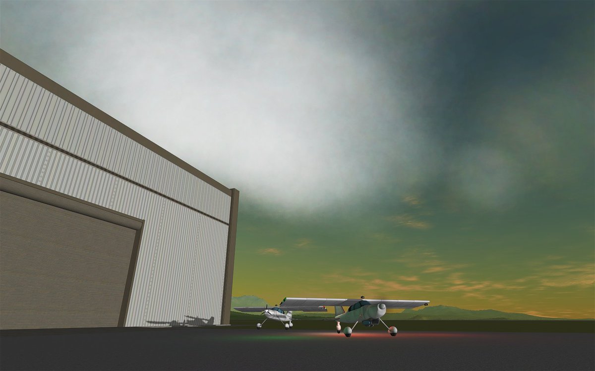
suit up! Jeb is prepping for his science flight in a Civvie at 3rd sunrise, which is why Tedman has to wait until tomorrow for his flight
Kerbal Space Agency
@KSA_MissionCtrl
to clarify a bit better, we can't yet operate two aircraft is such close proximity. Jeb has the airspace all to himself this day cycle
Kerbal Space Agency
@KSA_MissionCtrl
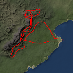
Jeb is briefed & out to preflight, looking forward to "meandering" again, this time amongst the Highlands/Mountains out to the north & west
Kerbal Space Agency
@KSA_MissionCtrl
Civvie is taxiing out to Rwy27, winds are still calm so Jeb is choosing to head out in the direction he needs to go. Clouds broken @ 4.7km
Kerbal Space Agency
@KSA_MissionCtrl
after a good departure Jeb is climbing thru 1km on course for the Highlands north of KSC, will travel their length southwest until LOS
Kerbal Space Agency
@KSA_MissionCtrl
lo-fi data will be collected & stored on this leg, given that we already have extensive data for this area (see bit.ly/AtmoInstrTestF…)
Kerbal Space Agency
@KSA_MissionCtrl
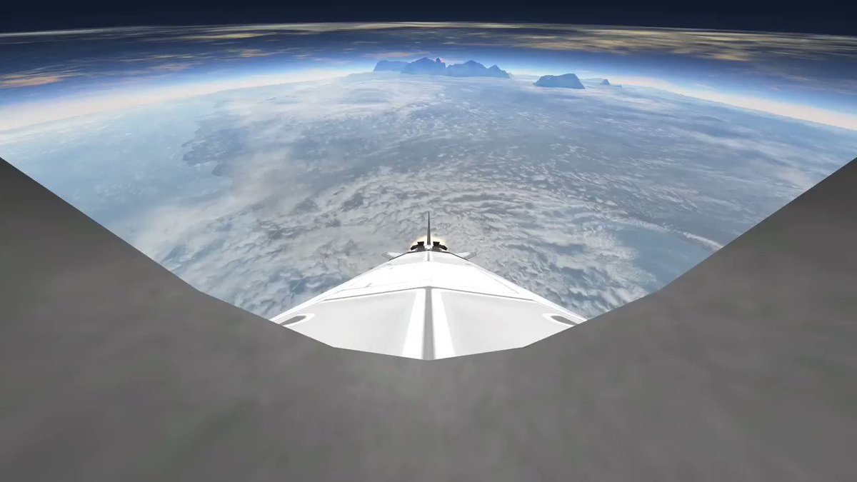
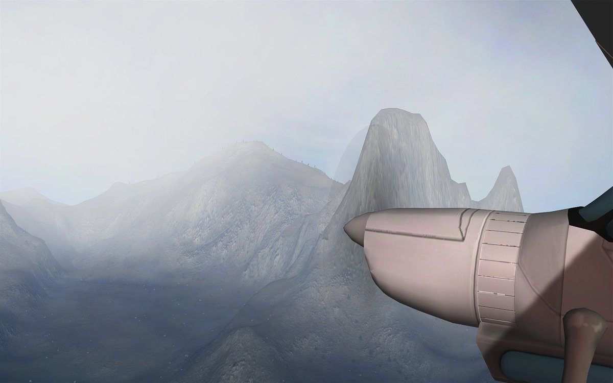
cruising past the Skyspire, tallest point in the Western Mountains. Jeb is ~1/2 thru the Highlands leg currently @ 4.3km (climbing to 4.5)
Kerbal Space Agency
@KSA_MissionCtrl
we've lost direct signal to Jeb, who should now be turning about towards the west and sidling up closer to the mountains on his return leg
Kerbal Space Agency
@KSA_MissionCtrl
signal re-acquisition & data stream confirmed @ 508kb/s - we'll be downlinking higher-quality data on this leg, around a total of 800MB
Kerbal Space Agency
@KSA_MissionCtrl
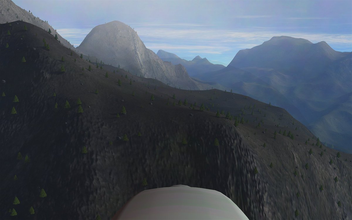
skimming just a few hundred meters over the mountains. Jeb is cruising ~97m/s & watching speed carefully, >100m/s can damage the instrument
Kerbal Space Agency
@KSA_MissionCtrl
north of KSC we had to vector Jeb off a westerly heading as the VAB was actually blocking line of sight on the narrow-beam transmission! 😛
Kerbal Space Agency
@KSA_MissionCtrl
another signal break, Jeb accidentally flew a bit too far west & ended up behind the mountains. Flight working on giving him better vectors
Kerbal Space Agency
@KSA_MissionCtrl
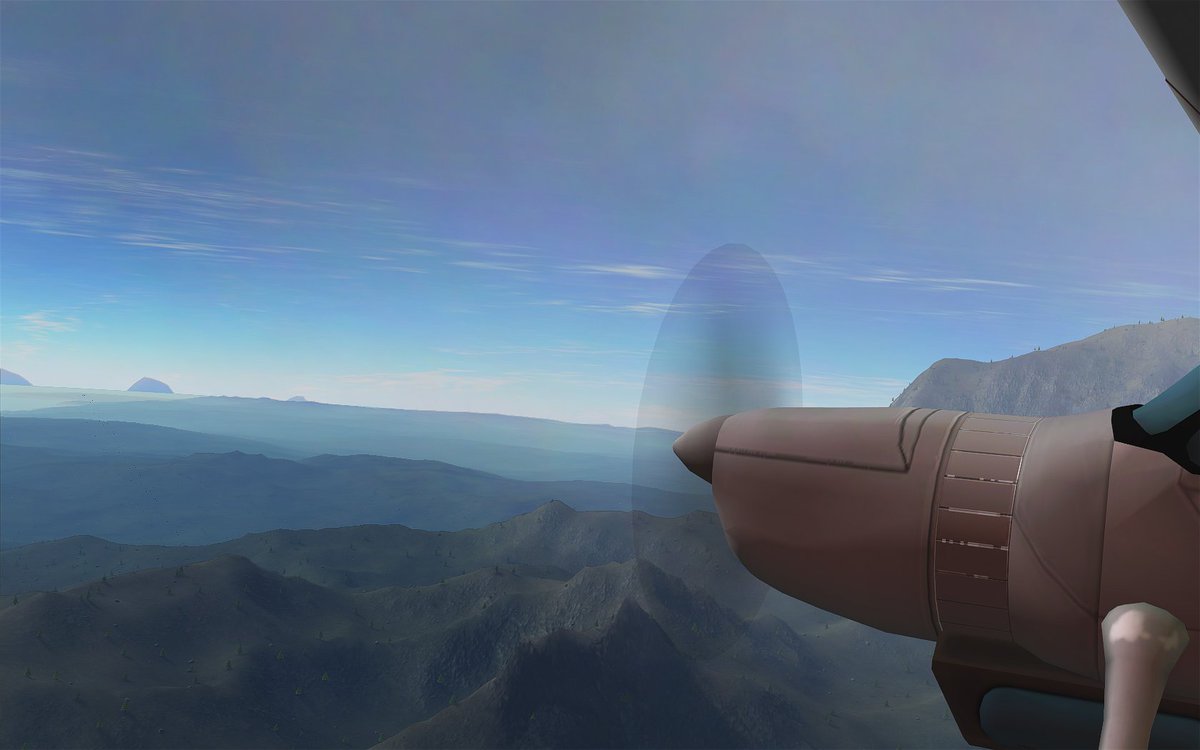
792MB of data received, checksum good, Jeb has already descended slowly to 3.7km & is now expediting descent & turning back towards KSC
Kerbal Space Agency
@KSA_MissionCtrl
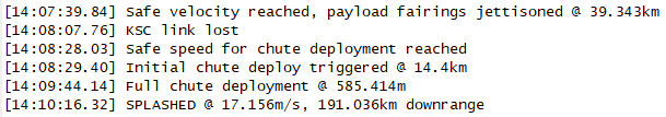
Jeb is on base leg, cleared to land Rwy27, winds picked up & are now 6-8kts @ 293. Rescue boat is standing by for the over-water approach
Kerbal Space Agency
@KSA_MissionCtrl
Jeb is taxiing in after bumping down at 37m/s. Tedman was in Flight Ctrl spectating the whole operation & taking notes. Studious!
Kerbal Space Agency
@KSA_MissionCtrl
post-debrief, Jeb has another photo to share from when he was NW of KSC over the mountains trying to keep in sight of the Tracking Station
Kerbal Space Agency
@KSA_MissionCtrl
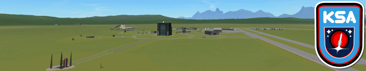
another busy week wraps up here at KSC. Even if you saw it all, additional info almost always included in our bit.ly/OpsSummary6-12…